How Cold Is Too Cold to Run? The Limit Is Wind Chill on Bare Skin
Every cold-running threshold you see quoted, reconciled into one position, plus typical and cold January mornings in US cities from NOAA's 1991-2020 normals.
Short answer
For a healthy adult runner, no air temperature alone rules a run out. The limit is how fast bare skin freezes, which the wind chill measures. The NWS chart, ACSM and Environment Canada put 30-minute frostbite risk at about -17 to -18°F (-27 to -28°C). Below a 5°F (-15°C) wind chill, the default is indoors, or a short, fully covered run you can cut.
It is quarter past six in January, the phone says 12°F (-11°C) and "feels like -4°F", and you are standing at the door in your second layer wondering whether this is a run or a bad idea. You search it, and the first few pages give you a different number each: 0°F, a wind chill of 15°F, -10°F, -18°F, -20°F. Few of them say where the number comes from, and one gives you two of them in the same paragraph without saying which to believe.
For a healthy adult runner, no air temperature on its own rules a run out. What sets the limit is how quickly bare skin can freeze, which is what the wind chill measures, and how far from warmth you will be if you have to stop. The official frostbite lines, from the National Weather Service chart, the American College of Sports Medicine (2021) and Environment Canada, start around a wind chill of -17 to -18°F (-27 to -28°C), where exposed skin can freeze within 30 minutes. Above about 5°F (-15°C) wind chill, the cold is a clothing question, and ice, wet kit and darkness are the real risks. In between, RunWeather is deliberately stricter than the official lines and flags any wind chill below 5°F (-15°C) as unsafe, so the default there is indoors, or a short, fully covered run you can cut.
For layering basics, the running in the cold guide has the short version. This post is about where the limit sits, why the numbers on the web disagree, and what a cold January morning looks like in your city.
The numbers you see quoted, and what each one means
Most of the disagreement comes from mixing air temperatures, wind chills and planning steps written for athletic trainers.
| Number you see | Where it comes from | What it actually says |
|---|---|---|
| "0°F is fine with layers" | Running websites | An air temperature with no wind. At 15 mph the same 0°F is a -19°F (-28°C) wind chill, and the NWS says exposed skin "can freeze in 30 minutes" |
| Wind chill 30, 25 and 15°F (-1, -4, -9°C) | NATA position statement, 2008 | Planning steps for athletic trainers: be aware, then add clothing and cover skin, then consider modifying the session |
| Wind chill 0°F (-18°C) | NATA, 2008 | "Consider terminating or rescheduling activity", for organised athletics |
| Air above 5°F (-15°C) | ACSM consensus statement, 2021 | The risk of frostbite on bare skin is "less than 5 %" |
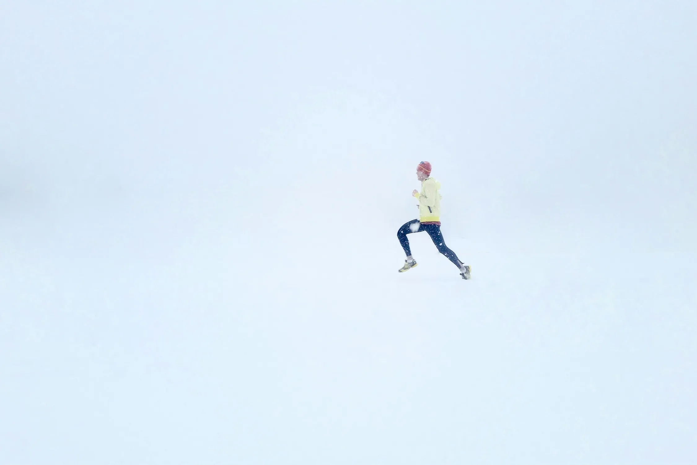
| Wind chill 5°F (-15°C) | RunWeather | The hour reads unsafe and the exact pace target is hidden |
| Wind chill -17°F (-27°C) | ACSM, 2021 (the 2006 position stand wrote -18°F) | "Increased safety surveillance is warranted", because frostbite "can occur in 30 min or less" |
| Wind chill -18°F (-28°C) | Environment Canada | High risk: "any exposed skin can freeze in 10 to 30 minutes" |
| Air above 32°F (0°C) | NWS wind chill FAQ | "You can only get frostbite if the actual air temperature, not the wind chill temperature, near your skin is below freezing" |
The famous "-18°F" is the ACSM line, and it is often quoted as "too cold to run", which is not what ACSM wrote. Its 2006 position stand recommended "heightened surveillance of exercisers" below a wind chill of -27°C, which it printed as -18°F; the 2021 consensus statement gives the same -27°C as -17°F, the more exact conversion. Either way it is a line for watching people closely, not a ban, and the 0°F wind chill line belongs to athletic trainers deciding whether a whole team should be out.
One position, in three bands
Put those lines together and you get three bands. The lower edge is where the official sources start warning about 30-minute frostbite. The upper edge, 5°F (-15°C), is the stricter line from the top of this post, set well above the frostbite zone on purpose. The advice in the right-hand column is mine, for a healthy adult who is dressed for the cold.
| Wind chill | What the official sources say about bare skin | What I would do with a run |
|---|---|---|
| Above 5°F (-15°C) | Environment Canada: low to moderate risk. ACSM: frostbite risk under 5% while the air stays above -15°C | Run. Dress for it, cover hands and ears, and worry about ice, wet kit and darkness first |
| 5°F to -17°F (-15°C to -27°C) | Environment Canada, moderate: "risk of hypothermia and frostbite if outdoors for long periods of time without adequate protection" | Indoors, or a short, fully covered run you can cut, on loops near home or somewhere warm. Turn back at the first numb or pale patch |
| -18°F (-28°C) and colder | Exposed skin can freeze in 30 minutes or less (NWS chart, ACSM 2021); "10 to 30 minutes" (Environment Canada, high risk) | Indoors |
It is a slope, not a cliff. Nothing happens to your cheeks at exactly -17°F that did not nearly happen at -15°F; the bands exist because people need a line to act on. The chart's frostbite times are also cautious by design: the ACSM statement describes them as "the risk of cheek frostbite in the most susceptible 5 % of the population."
What a cold January morning looks like in US cities
To make the bands concrete, the table takes January mornings at 6am from NOAA's 1991-2020 hourly climate normals for 21 US airport stations. "Typical" is the average 6am. "Cold" is the 10th percentile, the temperature that 1 morning in 10 at that hour is colder than. These are average hours, not a forecast, and an airport is not your street: New York is LaGuardia, not Central Park, and wind is measured 10 m above open ground, usually windier than a sheltered street. You can check every value in the NCEI normals dataset, for example the raw API response for Minneapolis-St Paul for one day, 15 January; the table averages all 31 days of the month.
| City (airport) | Typical 6am | Typical wind chill | Cold 6am (1 in 10) | Cold-morning wind chill (approx.) | Environment Canada band, cold morning |
|---|---|---|---|---|---|
| Minneapolis-St Paul | 13°F (-10°C) | 3°F (-16°C) | -7°F (-22°C) | -23°F (-31°C) | High |
| Chicago O'Hare | 22°F (-6°C) | 12°F (-11°C) | 3°F (-16°C) | -11°F (-24°C) | Moderate |
| Denver | 25°F (-4°C) | 17°F (-9°C) | 11°F (-12°C) | -3°F (-19°C) | Moderate |
| Boston Logan | 27°F (-3°C) | 18°F (-8°C) | 12°F (-11°C) | -2°F (-19°C) | Moderate |
| Salt Lake City | 27°F (-3°C) | 21°F (-6°C) | 16°F (-9°C) | 6°F (-14°C) | Moderate |
| Philadelphia | 31°F (-1°C) | 24°F (-5°C) | 17°F (-8°C) | 6°F (-14°C) | Moderate |
| New York (LaGuardia) | 32°F (0°C) | 23°F (-5°C) | 18°F (-8°C) | 5°F (-15°C) | Moderate |
| Washington DC (Reagan) | 33°F (1°C) | 27°F (-3°C) | 20°F (-7°C) | 10°F (-12°C) | Moderate |
| Nashville | 35°F (2°C) | 30°F (-1°C) | 18°F (-8°C) | 9°F (-13°C) | Moderate |
| Atlanta | 39°F (4°C) | 34°F (1°C) | 25°F (-4°C) | 16°F (-9°C) | Low |
| Dallas-Fort Worth | 40°F (5°C) | 35°F (2°C) | 28°F (-2°C) | 19°F (-7°C) | Low |
| Seattle-Tacoma | 40°F (4°C) | 35°F (2°C) | 31°F (-1°C) | 23°F (-5°C) | Low |
NOAA NCEI 1991-2020 hourly normals, January mean at 6am. Typical wind chill is NCEI's own wind chill normal. The cold-morning wind chill applies the NWS formula to the 10th-percentile temperature with the hour's mean wind; the coldest mornings are often calmer than average, so this leans cold. Environment Canada bands use the wind chill in °C, and only when the air is at or below 0°C.
On an ordinary January morning, the cold is not the limit almost anywhere. Across all 21 stations, only Minneapolis and Chicago reach Environment Canada's moderate band at a typical 6am. On the 1-in-10 cold morning, 8 of the 21 sit in the moderate band, the cold-morning wind chill drops below 5°F (-15°C) in Minneapolis, Chicago, Denver and Boston and sits within a degree or two of it at LaGuardia, Philadelphia and Salt Lake City, and only Minneapolis gets into the high band and the NWS chart's 30-minute frostbite zone. So for most US runners, the hard limit is a handful of mornings a winter, not a season. The Run Score calculator page for Minneapolis shows how its months compare.
The sun is not in any of these numbers. The NWS wind chill "assumes no impact from the sun, i.e., clear night sky," and notes that "bright sunshine may increase the wind chill temperature by 10°F to 18°F." A 6am January reading is a night reading. If you can move the run, the afternoon in the same normals is usually about 11°F (6°C) warmer.
A runner makes their own wind
Maurice Bluestein and Randall Osczevski, who designed the wind chill chart, built it for a face walking into the wind at 3 mph (1.34 m/s), with the face-level wind taken as two thirds of the wind measured at 10 m. A runner moves faster than that, so on a still morning you bring your own wind with you.
Feed the chart's own assumptions a runner's speed, which is our arithmetic and not an official index, and a calm 0°F (-18°C) morning gives a face-level wind chill of about -10°F (-23°C) at a 10-minute mile (6:13 per km) and about -13°F (-25°C) at 8 minutes per mile (4:58 per km). The formula is rough at these low wind speeds, so read them as a direction, not a precise number. Into a 10 mph (16 km/h) wind, the runner's face reaches about -19 to -20°F (-28 to -29°C), across the 30-minute line; with the wind behind you, it can be as mild as the air itself. Running also works in your favour, since "exercise of sufficient intensity increases skin perfusion and reduces skin cooling and cold injury risk," in ACSM's words, and the chart does not model that either.
What moves the line for you
The bands assume a healthy adult in dry kit who keeps moving. Several ordinary things move the line warmer.
Wet skin and clothing come first, because, in ACSM's words, "wet skin cools more rapidly and may increase risk." Then stopping. ACSM writes that in cold air "hypothermia is most likely to occur if an individual becomes injured or exhausted and is no longer able to exercise," which is why a twisted ankle five miles from home is the scenario to plan for, not the first mile. Hands go before faces, because "exposed fingers will freeze at a warmer WCT than the cheek," and bare skin on cold metal can freeze "within a few seconds."
Some people start closer to the line. ACSM lists previous cold injury, Raynaud's phenomenon, diabetes, peripheral vascular disease, smoking, fatigue and dehydration among the factors that raise frostbite risk, and NATA adds lean body composition and lower fitness. The 2006 ACSM stand says people with asthma and cardiovascular disease "can exercise in cold environments, but should be monitored closely", so if that is you, agree a cold-weather plan with your doctor. The NWS adds that its wind chill tests were done on adults, so be "even more cautious with children, the elderly, and persons with compromised health."
Ice underfoot and the dark at 6am
On most cold mornings, the thing that should change your plan is underfoot. A clear, still night after a thaw is the classic black ice setup, and a forecast cannot confirm that a pavement is clear of ice, so check the route itself and, on ice, run by feel with no pace target. The other is light. At 6am in mid-January it is dark in all 21 cities in the NOAA dataset, and drivers recognise runners far sooner with reflectors on the ankles and wrists than in a vest (running in the dark).
Warning signs on the run, and what to do
Frostbite gives warning if you look for it. The NWS lists "a loss of feeling in the extremity and a white or pale appearance," and Environment Canada says to "check your face and extremities for numbness or whiteness." ACSM calls a pale spot a superficial cold injury, to be rewarmed "by contact with warm skin", so cup a gloved hand over your cheek, put cold fingers under your armpit, and head for somewhere warm.
Once inside, the NHS advises warm, not hot, water and not rubbing the area. Get medical help if you think you have frostbite; the NHS treats hard or frozen skin, swelling with loss of feeling, or blisters as an emergency (999 in the UK, 911 in the US). The NWS warning signs of hypothermia are "uncontrollable shivering, memory loss, disorientation, incoherence, slurred speech, drowsiness and exhaustion," and its advice is to get medical attention immediately.
Making the call on a cold morning
Read the wind chill for the hour you will actually be out, not the day's headline. Then ask three questions: how much skin will be showing, how far from warmth the loop takes you, and what is underfoot. If the answer to the first is none, the second is a few minutes, and the third is dry pavement, a wind chill of -10°F (-23°C) can be a short winter run, the kind you cut at the first numb patch. If any answer is worse, the line moves. The free Run Score calculator shows your city's hours side by side.
Cold air is some of the best running weather there is, and most winter mornings are a matter of the right layers and a sensible loop. The few bad ones are easy to spot if you look: a wind chill below 5°F (-15°C), a numb patch on your cheek, a frozen puddle at the end of the drive. Take those seriously, and run the rest.
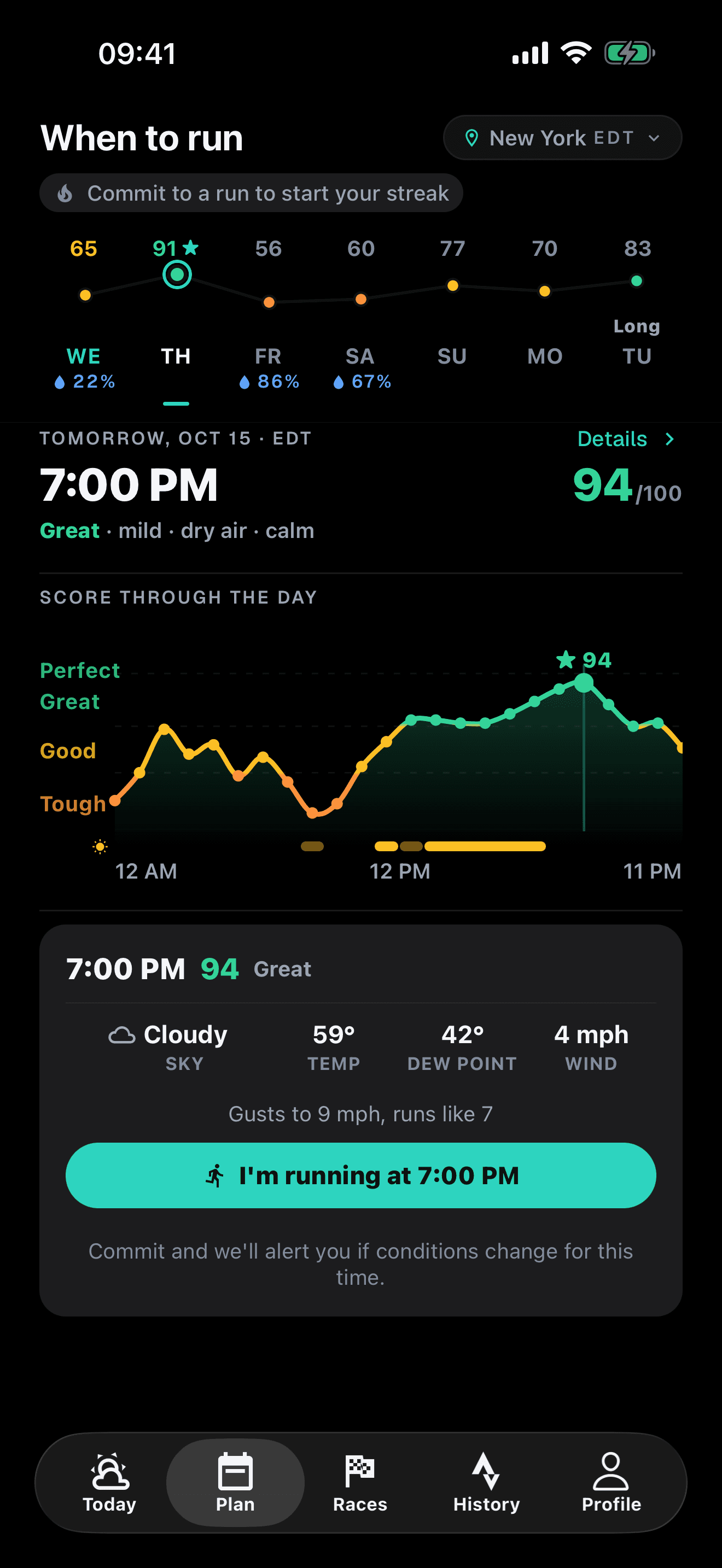
The score for every hour of the day, so you can pick the one you will be out in.
Frequently asked questions
Is it safe to run in 20 degree weather?
For most healthy adults, yes, with layers and with your hands and ears covered. At 20°F (-7°C) even a 20 mph (32 km/h) wind gives a wind chill of about 4°F (-15°C), which sits in Environment Canada's moderate band and outside the frostbite zones on the NWS chart. That is right at the 5°F (-15°C) wind chill line, below which the default is indoors, or a short, fully covered run you can cut, so on a day that windy, cover your face too. Ice is the more likely problem at that temperature, so check the footing.
Can you run when it is 0°F (-18°C)?
It depends on the wind. In calm air, 0°F is in Environment Canada's moderate band. With a 15 mph (24 km/h) wind, the NWS wind chill is -19°F (-28°C), and exposed skin can freeze in 30 minutes. Either way the sensible default is indoors, or a short, fully covered run you can cut: loops near home, turning back at the first numb or pale patch.
What wind chill is too cold to run?
The official sources meet at about -17 to -18°F (-27 to -28°C), where exposed skin can freeze in 30 minutes or less, according to the NWS chart, ACSM and Environment Canada. I would draw the line well above that, at a wind chill of 5°F (-15°C). Between the two, the default is indoors, or a short, fully covered run you can cut.
Can you get frostbite running when it is above freezing?
No. The National Weather Service says frostbite needs the actual air temperature near your skin to be below freezing, whatever the wind chill reads. You can still get dangerously cold above freezing if you are wet and stop moving, which is how hypothermia happens on cold, rainy days.
Sources and further reading
- National Weather Service: Understanding wind chill (formula, definition and FAQ)
- National Weather Service: Wind chill chart with frostbite times (PDF)
- National Weather Service: Wind chill questions (frostbite and hypothermia)
- Environment and Climate Change Canada: Wind chill and the Wind Chill Index
- Castellani JW et al. ACSM expert consensus statement: injury prevention and exercise performance during cold-weather exercise (Curr Sports Med Rep, 2021), full text
- Castellani JW et al. ACSM position stand: prevention of cold injuries during exercise (Med Sci Sports Exerc, 2006)
- Cappaert TA et al. National Athletic Trainers' Association position statement: environmental cold injuries (J Athl Train, 2008)
- Bluestein M, Osczevski R. The basis for the new wind chill temperature chart (AMS, 2002)
- NOAA NCEI: U.S. Climate Normals 1991-2020
- NHS: Frostbite
Related reading
- Running in the cold: wind chill, layers and staying safe
- Treadmill vs outdoor running: a weather decision guide
- What to wear running: the guide for every temperature
RunWeather is available now on the App Store and Google Play.